


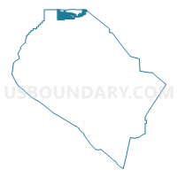
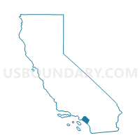
Voting District 34471, Orange County, California
About
Outline

Summary
| Unique Area Identifier | 536149 |
| Name | Voting District 34471 |
| County | Orange County |
| State | California |
| Area (square miles) | 11.00 |
| Land Area (square miles) | 10.97 |
| Water Area (square miles) | 0.03 |
| % of Land Area | 99.72 |
| % of Water Area | 0.28 |
| Latitude of the Internal Point | 33.92990640 |
| Longtitude of the Internal Point | -117.86248140 |
Maps

Graphs
Select a template below for downloading or customizing gragh for Voting District 34471, Orange County, California


Neighbors
Neighoring Voting District (by Name) Neighboring Voting District on the Map
- Voting District 30681, Orange County, CA
- Voting District 32601, Orange County, CA
- Voting District 32611, Orange County, CA
- Voting District 33491, Orange County, CA
- Voting District 34381, Orange County, CA
- Voting District 34382, Orange County, CA
- Voting District 34406, Orange County, CA
- Voting District 34444, Orange County, CA
- Voting District 34446, Orange County, CA
- Voting District 34466, Orange County, CA
- Voting District 34472, Orange County, CA
- Voting District 34473, Orange County, CA
- Voting District 34476, Orange County, CA
- Voting District 34481, Orange County, CA
- Voting District 34491, Orange County, CA
- Voting District 42581, Orange County, CA
- Voting District 44376, Orange County, CA
- Voting District 44488, Los Angeles County, CA
- Voting District 44551, Los Angeles County, CA
- Voting District 44600, San Bernardino County, CA
Top 10 Neighboring County Subdivision (by Population) Neighboring County Subdivision on the Map
- Anaheim-Santa Ana-Garden Grove CCD, Orange County, CA (1,648,519)
- East San Gabriel Valley CCD, Los Angeles County, CA (935,875)
- Ontario CCD, San Bernardino County, CA (615,598)
Top 10 Neighboring Place (by Population) Neighboring Place on the Map
- Fullerton city, CA (135,161)
- Chino Hills city, CA (74,799)
- Yorba Linda city, CA (64,234)
- Rowland Heights CDP, CA (48,993)
- Brea city, CA (39,282)
Top 10 Neighboring Elementary School District (by Population) Neighboring Elementary School District on the Map
- Fullerton Elementary School District, CA (118,074)
- La Habra City Elementary School District, CA (49,429)
Top 10 Neighboring Secondary School District (by Population) Neighboring Secondary School District on the Map
Top 10 Neighboring Unified School District (by Population) Neighboring Unified School District on the Map
- Chino Valley Unified School District, CA (172,848)
- Placentia-Yorba Linda Unified School District, CA (154,626)
- Rowland Unified School District, CA (108,966)
- Walnut Valley Unified School District, CA (56,658)
- Brea-Olinda Unified School District, CA (38,217)
Top 10 Neighboring State Legislative District Lower Chamber (by Population) Neighboring State Legislative District Lower Chamber on the Map
Top 10 Neighboring State Legislative District Upper Chamber (by Population) Neighboring State Legislative District Upper Chamber on the Map
Top 10 Neighboring 111th Congressional District (by Population) Neighboring 111th Congressional District on the Map
Top 10 Neighboring Census Tract (by Population) Neighboring Census Tract on the Map
- Census Tract 16.01, Orange County, CA (7,989)
- Census Tract 218.15, Orange County, CA (7,751)
- Census Tract 15.05, Orange County, CA (6,876)
- Census Tract 218.14, Orange County, CA (6,816)
- Census Tract 4087.03, Los Angeles County, CA (6,528)
- Census Tract 15.01, Orange County, CA (6,373)
- Census Tract 117.07, Orange County, CA (6,045)
- Census Tract 15.03, Orange County, CA (5,099)
- Census Tract 4033.25, Los Angeles County, CA (4,795)
- Census Tract 15.07, Orange County, CA (4,665)
Top 10 Neighboring 5-Digit ZIP Code Tabulation Area (by Population) Neighboring 5-Digit ZIP Code Tabulation Area on the Map
- 91709, CA (74,796)
- 92886, CA (46,564)
- 91765, CA (46,457)
- 91748, CA (45,406)
- 92821, CA (35,533)
- 92835, CA (24,010)
- 92823, CA (3,613)